Before you break ground on a new project, there’s one question many property owners don’t think to ask right away:
Does your site include wetlands? These areas may look like open land at first glance, but they play a major role in
flood control, water quality, and wildlife protection. Because of their importance, most construction and
development projects are required to identify wetlands early in the planning process.
That’s where wetland delineation comes in. It’s the process that helps you understand exactly where wetlands begin
and end on your property. When you know this early, you avoid redesigns, permit delays, and compliance problems
later. More importantly, it gives you a clearer path to move forward with your project the right way.
What Is Wetland Delineation?
Wetland delineation is the scientific process used to identify, classify, and map wetlands on a property. A
professional wetland delineation determines whether certain areas meet federal and state definitions of regulated
wetlands.
To make that determination, environmental professionals look for three key indicators:
- HydrologyThis shows whether water is present at or near the ground surface for extended periods. Signs include soil
saturation, standing water, or groundwater influence. - Hydric SoilsThese soils form under wet conditions and often show gray coloring, mottling, or high organic content, clear
signs of long-term water saturation. - Hydrophytic VegetationThese are plant species adapted to wet environments, such as sedges, rushes, wetland grasses, and
water-tolerant
trees and shrubs.
When all three indicators are present, the area is classified as a regulated wetland.
Why Wetlands Delineation Is Required
Wetlands delineation is required for many land-use activities, including construction, land clearing, roadways,
utilities, and larger development projects. If a project falls under federal, state, or local wetland regulations,
delineation is often the first step.
Completing a wetland delineation early helps to:
- Identify environmental constraints upfront
- Support smarter site design and planning
- Avoid violations of environmental laws
- Reduce permitting delays and unexpected redesign costs
- Ensure responsible land and resource management
In many cases, agencies won’t even review permit applications without a completed wetland delineation.
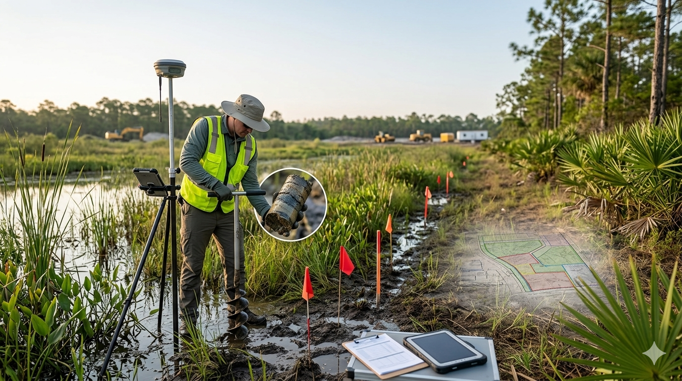
How the Wetland Delineation Process Works
While every site is different, most wetland delineation surveys follow a similar process:
- Desktop ReviewEnvironmental professionals start by reviewing soil maps, aerial imagery, wetland inventories, and hydrology
data to understand the site before stepping into the field. - Field InvestigationThis is where field evaluation takes place. Specialists visit the site to evaluate vegetation, soils, and
hydrology conditions firsthand. - Boundary MappingWetland boundaries are flagged and mapped using GPS and surveying tools to clearly define where wetlands
begin and end. - Reporting and DocumentationAll findings are compiled into a formal wetland delineation report, which can be submitted to regulatory
agencies for verification, permitting, or project approval.
Why Wetlands Delineation Should Happen Before Construction
Timing matters. Completing wetlands delineation before construction gives project teams the flexibility to:
- Design around protected wetland areas
- Avoid enforcement actions or stop-work orders
- Accurately budget for mitigation if needed
- Reduce approval timelines and uncertainty
Projects that skip this step often run into problems when wetlands are discovered after plans are finalized or,
worse, after construction has already started.
How Long Does the Wetland Permitting Process Take?
Wetland permitting timelines vary based on project size, site conditions, and agency involvement.
Typical timeframes include:
- Residential projects: about 4-6 months
- Commercial or large projects: 6-12 months or longer
Because permits can take months to secure, starting with wetlands delineation early in the process helps keep
projects on schedule.
Agencies Involved in Wetland Permitting
Depending on where a property is located, one or more agencies may be involved, including:
- Florida Department of Environmental Protection (FDEP)
- Southwest Florida Water Management District (SWFWMD)
- South Florida Water Management District
- U.S. Army Corps of Engineers
Coordinating requirements across multiple agencies can be complex, which is why experienced environmental consultants are often essential.
Wetlands Delineation and Environmental Management
Wetlands delineation plays a key role in responsible land management. Once wetlands are identified, projects can often be designed to avoid impacts altogether.
When impacts can’t be avoided, agencies may require mitigation, such as:
- Wetland restoration
- Wetland creation or enhancement
- Preservation of existing wetlands
- Mitigation banking
The goal is to balance development needs with long-term environmental protection.
Common Challenges, Concerns, and Misconceptions
Many property owners assume wetlands are easy to spot but that’s not always the case. Some wetlands are seasonal, subtle, or hidden beneath vegetation.
Common misunderstandings include:
- Thinking that wetlands are only areas with standing water
- Assuming boundaries are obvious
- Underestimating regulatory requirements
Mistakes can lead to fines, redesigns, or project shutdowns. In reality, early wetland delineation is a smart investment that often saves both time and money.
Choosing the Right Environmental Consultant
Accurate wetlands delineation requires technical expertise and regulatory knowledge. Working with qualified professionals ensures:
- Reliable field data and site evaluations
- Accurate wetland boundary mapping
- Compliance with agency standards
- Clear guidance throughout permitting
The right consultant helps keep projects moving while protecting sensitive natural resources
Final Thoughts
Wetlands play an important role in protecting communities, supporting ecosystems, and shaping the future of our environment. Wetland delineation is a practical step that helps you plan smarter and build responsibly.
When you understand the process and address it early, you reduce delays, avoid costly changes, and keep your project moving forward with confidence. At the same time, you help protect the natural systems that make our landscapes stronger and more sustainable for years to come.
